Approach & Egress
How a person reaches your building on foot and by vehicle, and which routes are unobserved.
Capability: Aerial Survey
Every hazard assessment includes an aerial survey conducted by an FAA-Certified Remote Pilot (Part 107). Exterior exposure (approach, parking, perimeter) is where most site risk lives, and it is the part a walkthrough consistently underestimates.
Certification
Aerial survey work is conducted by an FAA-Certified Remote Pilot (Part 107), operating under 14 CFR Part 107. The imagery is captured directly by F1RST SIGNAL, not outsourced to a third-party drone vendor.
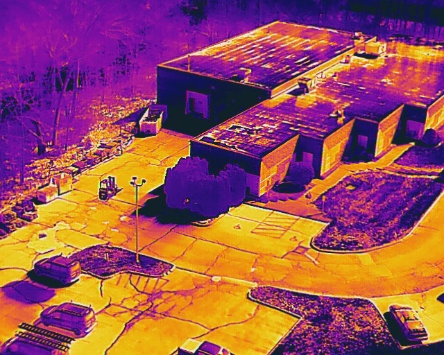
Example capture: thermal aerial view identifies exterior exposure, access routes, and perimeter sightlines that ground-level review misses.
What It Captures
How a person reaches your building on foot and by vehicle, and which routes are unobserved.
Lot layout, walking distance to entrances, and coverage gaps at shift change and after dark.
Fence lines, blind corners, loading areas, and vantage points overlooking occupied space.
Dated aerial imagery attached to the hazard assessment as part of your compliance record.
Flights are conducted under FAA Part 107 certification, within airspace rules and site-specific permissions, and imagery is retained as part of your compliance file.
Your obligation. Our expertise.
Start with a quick readiness check. Answer a few questions about your workplace and we'll show you exactly where your prevention program stands, and what to fix first.
Readiness Check
General information only. This check is not legal advice and does not determine compliance status.